Файл:1965 Spruner Map of the Caucasus and Iraq in Antiquity - Geographicus - CaucusesIraq-spruner-1865.jpg
Исходный файл (2975 × 3500 пкс, размер файла: 2,45 Мб, MIME-тип: image/jpeg)
Описание
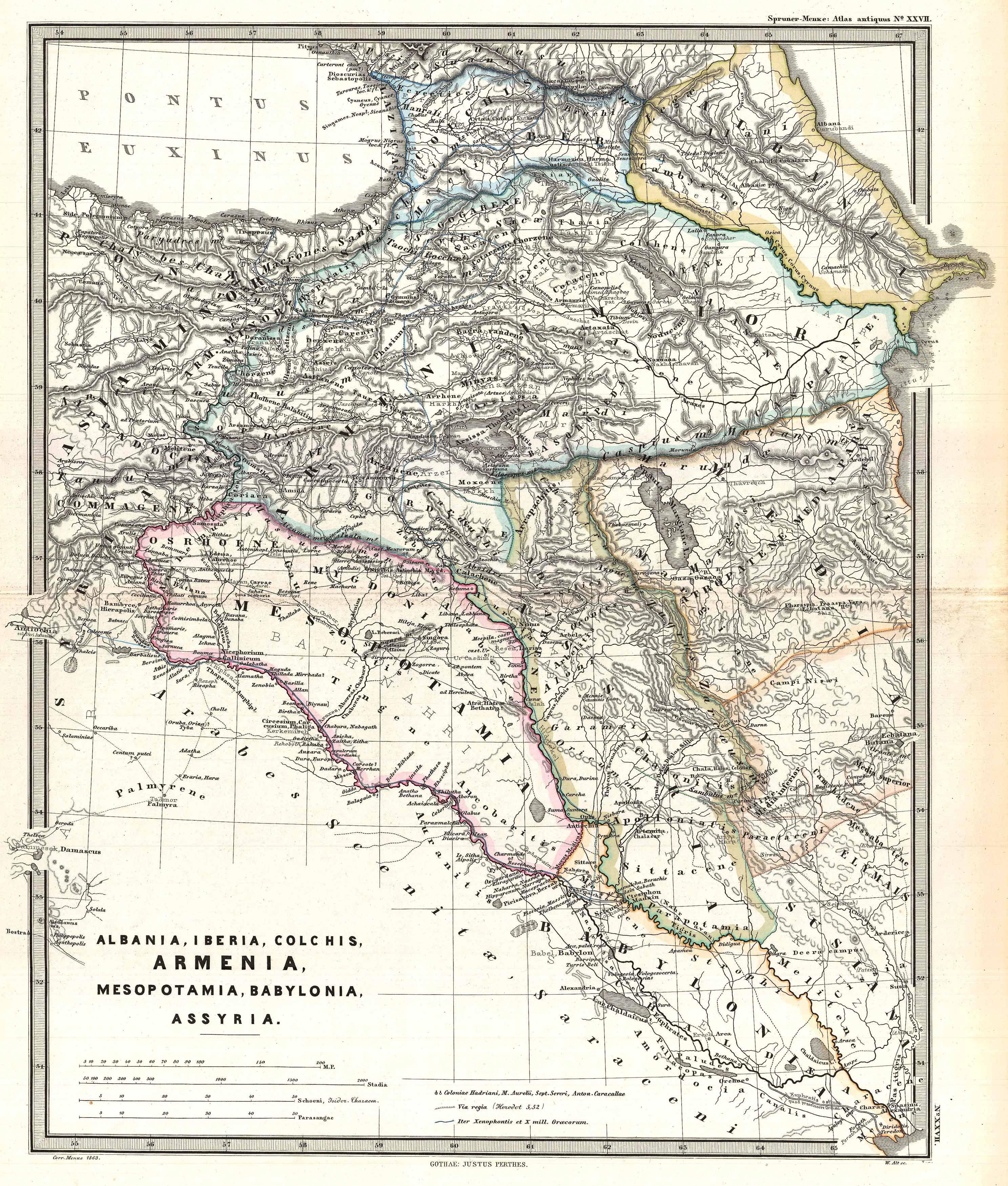
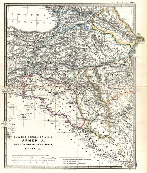
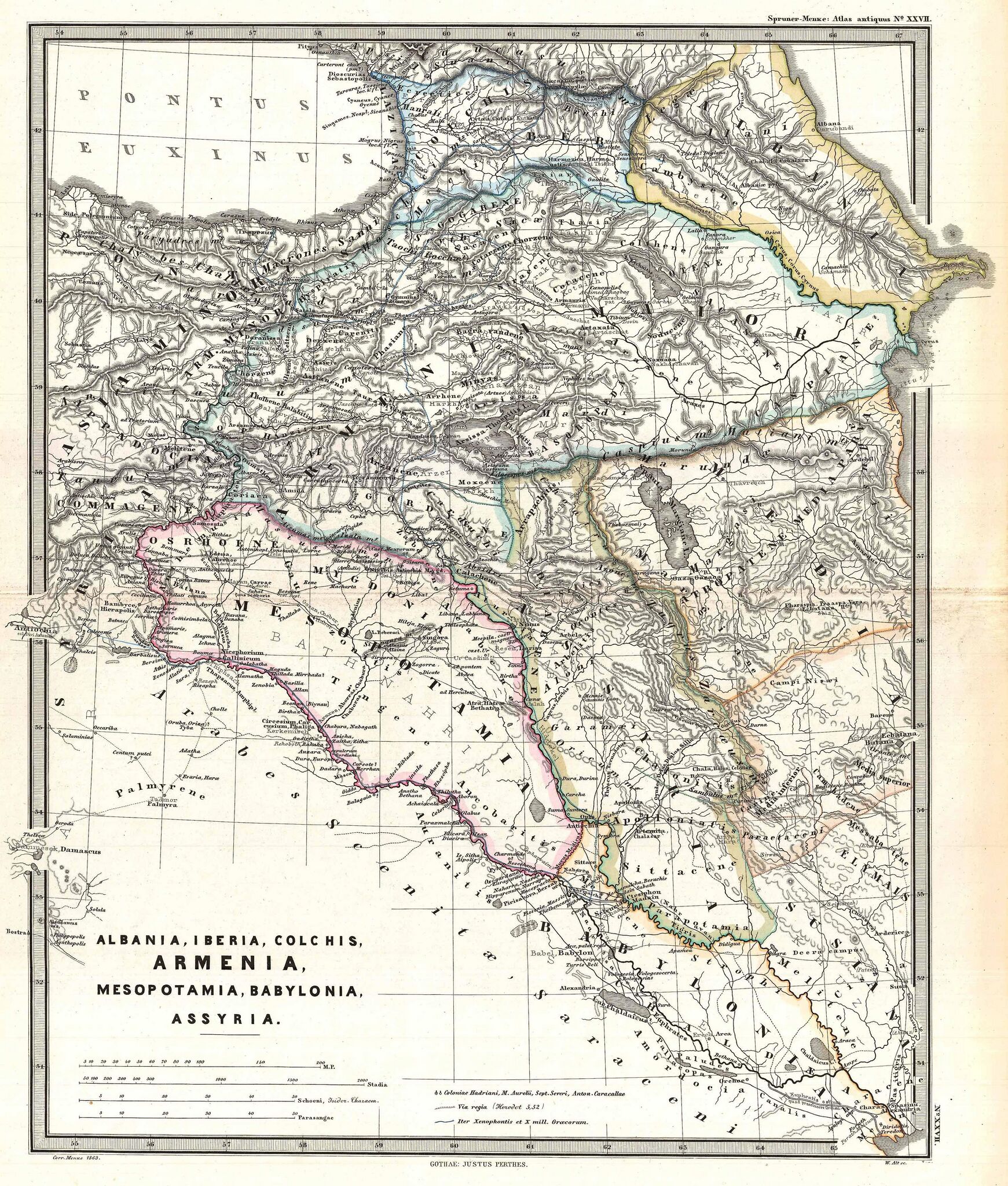
| Описание | A particularly interesting map, this is Karl von Spruner’s 1865 rendering of the Caucasus and Mesopotamia in antiquity. Centered on Lake Van (modern day eastern Turkey), this map covers the Caucasus region between the Black Sea and the Caspian Sea, then southwards to the Fertile Crescent as far as the Euphrates River, Babylonia, and the head of the Persian Gulf. These regions include the modern day countries of Iraq, Armenia, Georgia, Azerbaijan, and adjacent parts of Syria, Turkey, Iran, and the North Caucasus. Like most of Spruner’s work this example overlays ancient political geographies on relatively contemporary physical geographies, thus identifying the sites of forgotten towns and villages, the movements of armies, and the disposition of lands in the region. This particular example includes ancient names for many notable regions and historical sites. As a whole the map labels important cities, rivers, mountain ranges and other minor topographical detail. Territories and countries outlined in color. The whole is rendered in finely engraved detail exhibiting the fine craftsmanship for which the Perthes firm is known. |
|---|---|
| Источник | This file was provided to Wikimedia Commons by Geographicus Rare Antique Maps, a specialist dealer in rare maps and other cartography of the 15th, 16th, 17th, 18th and 19th centuries, as part of a cooperation project. |
| Время создания | 1865 (undated) |
| Автор или правообладатель | Karl Spruner von Merz
— Лицензия: Public domain (в общественном достоянии) |
| Другие версии файла | — |
Источник файла — сайт Wikimedia Commons, куда он был загружен под одной из свободных лицензий ( https://commons.wikimedia.org/wiki/File:1965_Spruner_Map_of_the_Caucasus_and_Iraq_in_Antiquity_-_Geographicus_-_CaucusesIraq-spruner-1865.jpg ). Авторов, работавших над этим файлом см. в истории файла: https://commons.wikimedia.org/w/index.php?title=File:1965_Spruner_Map_of_the_Caucasus_and_Iraq_in_Antiquity_-_Geographicus_-_CaucusesIraq-spruner-1865.jpg&action=history
В общем случае в статьях энциклопедии Руниверсалис файлы используются в соответствии со статьёй 1274 Гражданского кодекса Российской Федерации.
История файла
Нажмите на дату/время, чтобы увидеть версию файла от того времени.
| Дата/время | Миниатюра | Размеры | Участник | Примечание | |
|---|---|---|---|---|---|
| текущий | 07:33, 6 сентября 2023 | | 2975 × 3500 (2,45 Мб) | Я, робот (обсуждение | вклад) | == Описание == {{Изображение | описание = A particularly interesting map, this is Karl von Spruner’s 1865 rendering of the [https://en.wikipedia.org/wiki/Caucasus Caucasus] and [https://en.wikipedia.org/wiki/Mesopotamia Mesopotamia] in antiquity. Centered on [https://en.wikipedia.org/wiki/Lake_Van Lake Van] (modern day eastern [https://en.wikipedia.org/wiki/Turkey Turkey]), this map covers the Caucasus region between the [https://en.wikipedia.org/wiki/Black_Sea Black Sea] and the [https://e... |
Вы не можете перезаписать этот файл.
Использование файла
Следующий файл является дубликатом этого файла (подробности):
Следующая страница использует этот файл: